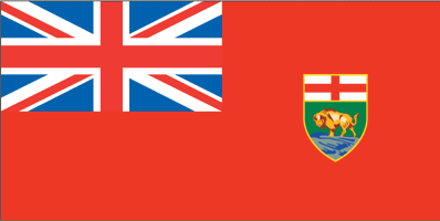
Manitoba
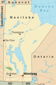
Along with Alberta and Saskatchewan, Manitoba is one of Canada's "prairie provinces". Its capital city is Winnipeg, known for its traditionally long, cold winters. The upper two-thirds of the province are sparsely populated and consist of lakes, rivers, and forests. The more populated regions are dramatically flat and sliced through by Trans-Canada Highway 1. The population of Manitoba began growing in the 1880s due to the arrival of railroads. Many immigrants arrived from the British Isles, Scandinavia, Holland, Germany, Russia, and Eastern Europe seeking free government land. In addition to an abundance of wide open spaces, Manitoba also offers many historical attractions focusing on native people, dinosaurs, railroads, and Mounties. The capital of Winnipeg is home to a symphony orchestra, a ballet company, two major theaters, and a strong arts community. A wide variety of cuisine is available in Manitoba, from Ukrainian, Italian, and Greek, to Scandinavian, French, and Japanese, reflecting the wide range of ethnicities which call the province home. Canadian beef is still a big product of the "prairie provinces", despite a case of mad cow disease in 2003. Manitoba is bordered on the east by Ontario, on the west by Saskatchewan, on the north by the Nunavut, and on the south by the states of North Dakota and Minnesota in the USA. The mildest months for a visit to Manitoba are June through September; this is also when you will find the greatest number of available lodgings. For those wishing to catch a glimpse of the famed northern lights, plan a trip between mid-August and early April. While winter is cold in Manitoba, it makes for great skiing, ice skating, and dog sledding. Warmer-weather activities include biking and jogging, fishing, horseback riding, and shopping. Manitoba Government LinksManitoba Tourism Links
Copyright © 2006-2024 Canada-Maps.org.
All rights reserved. Canada Maps - Manitoba |