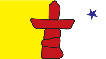
Nunavut
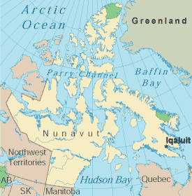
Along with the Yukon and the Northwest Territories, Nunavut is part of what is referred to as "Wilderness Canada". While the 28 communities of Nunavut are linked by modern communications and regional airlines, Nunavut is the only Canadian province to which there are no roads, making it a unique travel destination. No forests grow here either, because it lies entirely above the tree line. Due to its location, the sun never sets in summer, and night can last for around the clock in the winter. Nunavut has a square mileage of 818,923, but only 27,000 people live in the entire province. The Inuit are the native people of Nunavut, and Inuktitut is the main language spoken. However, most Inuit are also fluent in both English and French. Nunavut is bordered on the east by Hudson Bay and Baffin Bay, and on the west by the Northwest Territories. It is bordered the north by the Arctic Ocean, and on the south by Manitoba, Hudson Bay, and the Hudson Strait. Nunavut is one of the world's most remote places to live and an adventure to visit. In the summer and early fall, mosquitoes and blackflies are abundant, and insect repellant is a necessity. Planning a trip to this region requires much forethought and may be more expensive due to travel and lodging costs. However, it may be well worth it, as few people ever get a chance to experience this corner of the earth. Nunavut Government LinksNunavut Tourism Links
Copyright © 2006-2024 Canada-Maps.org.
All rights reserved. Canada Maps - Nunavut |