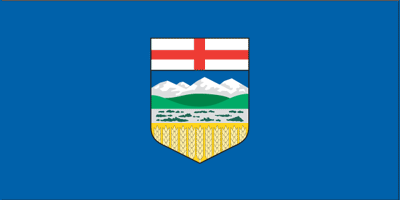
Alberta
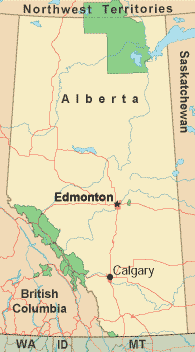
Along with Saskatchewan and Manitoba, Alberta is one of Canada's "prairie provinces". Its capital city is Edmonton and its primary commodities are wheat, oil, and beef. The upper two-thirds of the province are sparsely populated and consist of lakes, rivers, and forests. The more populated regions are dramatically flat and sliced through by Trans-Canada Highway 1. The population of Alberta began growing in the 1880s due to the arrival of railroads. Many immigrants arrived from the British Isles, Scandinavia, Holland, Germany, Russia, and Eastern Europe seeking free government land. A great point of interest is the city of Calgary, which was founded in 1875 as a North West Mounted Police post. This city of neighborly, easygoing people enjoys the most reasonable winter of any of the major prairie cities. City planners have also helped to insure cold weather comfort with a system called the Plus 15. This is a network of enclosed walkways 15 or more feet above street level. Calgary has professional football and hockey teams, and attracts worldwide visitors for its Calgary Stampede rodeo event in July. The cities of Calgary and Edmonton also boast close proximity to the Canadian Rockies and arguably some of the most breathtaking scenery on the continent. Food connoisseurs can choose from French, Greek, and Japanese food, as well as Scandinavian and Ukrainian cuisine, while dining in Alberta. The variety of foods reflects the wide range of ethnicities which call the province home. Although mad cow disease was present in the area in 2003, Canadian beef remains as a major product of the "prairie provinces". Alberta is bordered on the east by Saskatchewan, on the west by British Columbia, on the north by the Northwest Territories, and on the south by the State of Montana in the USA. The mildest time to visit Alberta, from a weather perspective, is from June through September; this is also when you will find the greatest number of festivals and available lodgings. For those wishing to catch a glimpse of the famed northern lights, plan a trip between mid-August and early April. While winter is cold in Alberta, it makes for great skiing, ice skating, and dog sledding. Warmer-weather activities include biking and jogging along the many paths Alberta has to offer, fishing, horseback riding, and shopping at the major shopping districts in Calgary. Alberta Government Links
Alberta Tourism Links
Copyright © 2006-2026 Canada-Maps.org.
All rights reserved. Canada Maps - Alberta |